More serious planning work began in the 1970s, when detailed studies and proposed routes of future lines were prepared, which would connect key parts of the city and relieve surface traffic. Although the project was then highly positioned in the urban plans, the economic crisis and subsequent socio-political events delayed its realization.
At the beginning of the 21st century, the idea of a metro system gained importance again. Through a series of feasibility studies, revisions of plans and international partnerships, a modern network concept was defined, adapted to the current demographic, spatial and traffic conditions. Today, the metro is seen not only as one of the infrastructural projects of the city, but also as an instrument of urban development, sustainable mobility and improving the quality of life.
Today's project is the result of long-term planning, expert analysis and institutional continuity in rethinking Belgrade's traffic system. Despite numerous interruptions and changes of the concept throughout history, the idea of the metro remained permanently present in the urban planning documents and strategic plans of the city. Its realization symbolizes the transition from the planning phase to the concrete implementation phase, which completes the multi-decade process of shaping one of the most significant infrastructural projects in the modern history of Belgrade.
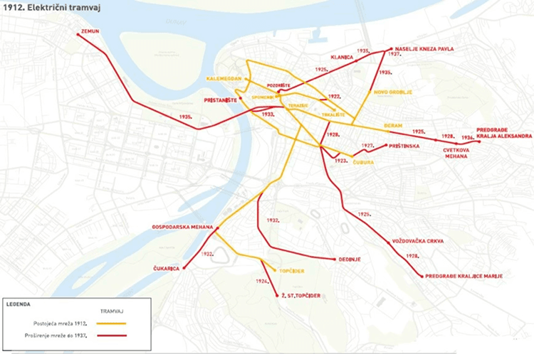
1912. Electric tram - the basis of public transport
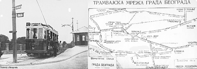
At the beginning of the 20th century, the electric tram became the backbone of urban transport in Belgrade. With the growth of the city came the first ideas about an independent, high-capacity rail system that would take over the busiest routes.
During the 1920s and 1930s, in the competitive solutions for planning the development of the city, ideas appeared about building a completely new rail system - the metro, because on some very busy sections and intersections, the tram system reached the limit of its capacity.
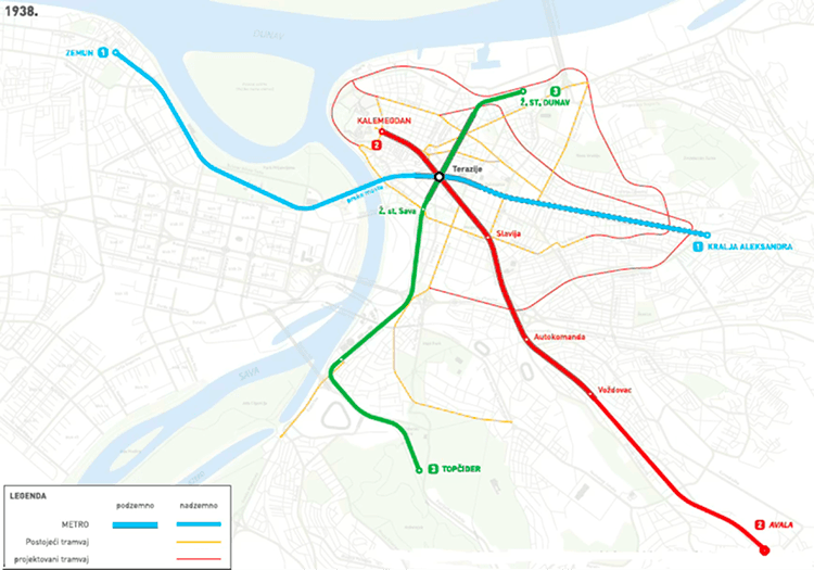
1938. The first concept of the metro network
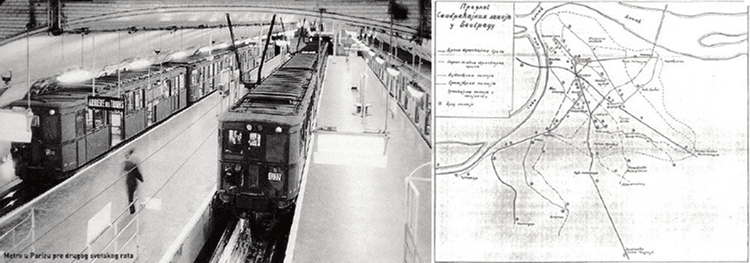
Considering the state of urban transport in Belgrade and looking at the limited capacities of the existing tram system, Ratimir D. Nikolić, with the vision of a future-oriented urbanist, recognized the challenges of a rapidly developing city. In his analyses, he pointed out that the existing traffic infrastructure could not meet the growing needs of the population in the long term, and that only the construction of the metro system represents a permanent systematic solution to traffic problems, as well as a reliable basis for the further urban expansion of Belgrade.
Accordingly, he proposed the phased construction of a radial network with three lines along the most congested directions, which would be connected at the common central station of Terazije - in the very heart of the city. This concept represented a bold and modern step forward in traffic planning, based on the principles of modern European metropolises.
However, the outbreak of the Second World War, which engulfed Yugoslavia, interrupted the development processes that had begun and put an end to all previous plans for the construction of the Belgrade metro.
1968. Study of the Belgrade Metro
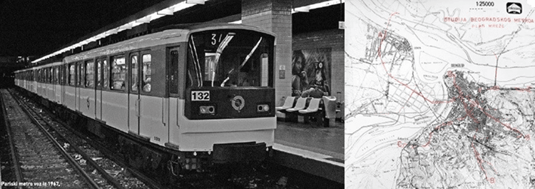
The general urban plan from 1950 laid the foundations for the modern development of Belgrade, foreseeing the functional connection of Belgrade and Zemun with the construction of a new city on the left bank of the Sava, with the parallel development of the key infrastructure - highway and railway junction. In the time of rapid population growth and accelerated motorization, there was an increasingly pronounced need for a vision of planned and sustainable development.
Faced with this challenge, in 1958, the city architect Nikola Dobrović proposed the construction of the first metro line on the route Kalemegdan - Terazije - Slavija - Čubura, recognizing the underground railway as the most effective answer to the growing traffic demands of the capital.
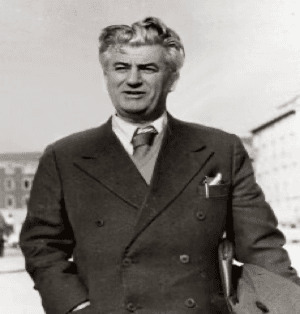
Nikola Dobrović – Prominent Serbian and Yugoslav architect and professor at the Faculty of Architecture in Belgrade.
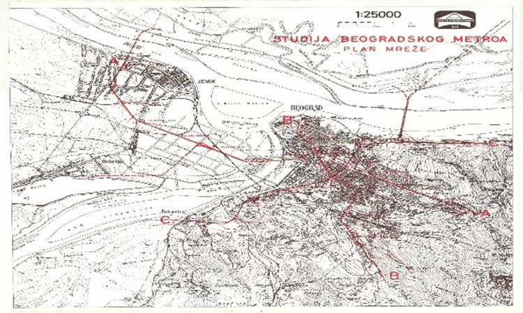
The study of the Belgrade Metro, published in 1968 and based on the settings of the 1950 plan, further elaborates this vision. A radial network with three lines was proposed, which would connect the most important points - Terazije, Tašmajdan and Slavija - with routes that would be mostly underground. Such a solution would enable a more even distribution of passenger flows in the narrower city core, relieving the existing traffic system and the long-term urban development of Belgrade in accordance with the modern European metropolises of that time.
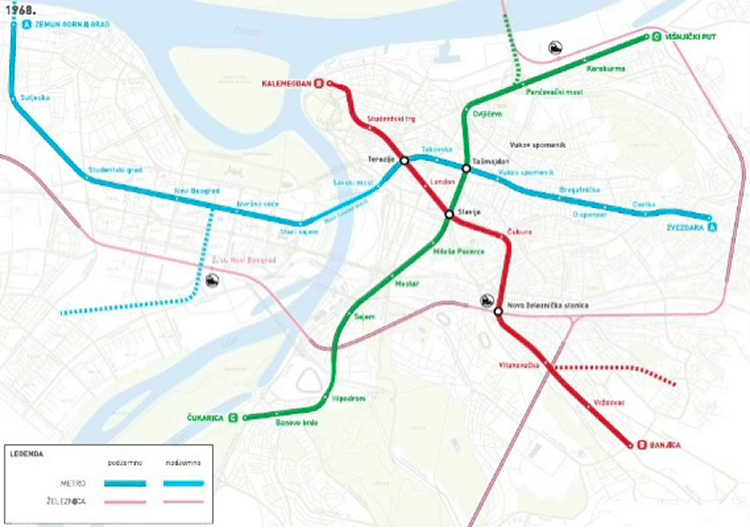
Izvor: „Studija Beogradskog metroa“, 1968.
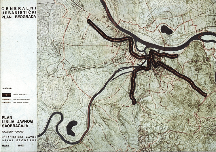
1972. General urban plan of the city of Belgrade in 1972, Urban Institute of the City of Belgrade
The general urban plan of Belgrade from 1972, drawn up by the Urban Institute of the City of Belgrade, gave the concept of the metro system clearer contours and a stronger strategic foundation in the development of the capital. In accordance with the urban projections of the time and the planned expansion of the city towards new secondary centers, the construction of two metro lines is planned as the backbone of future public transportation.
The first line is planned to connect the secondary city center in Vinci with the western parts of the city. Its route would lead along Revolucije Boulevard, through the Wolf Monument, Slavija and Terazije, to the central zone of New Belgrade and Zemun, with a further extension to the secondary center of Batajnica. This line was intended to unite the eastern and western parts of the wider city area into a single, functionally connected system.
The second line was designed in the direction of Petlovo bro - Banovo brdo - Prokop - the foot of Terazija - Studentski trg, from where it would follow the flow of the Danube and continue towards Karaburma. Its role was to connect the southern and northern zones of the city, relieve the central city core and ensure more efficient movement of passenger flows along one of the most important urban routes.
With this plan, the metro is confirmed as a key element of Belgrade's long-term development - as an axis infrastructure that follows the expansion and directs the future spatial and traffic development of the city.
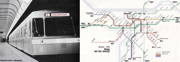
1976. "Belgrade 2000"
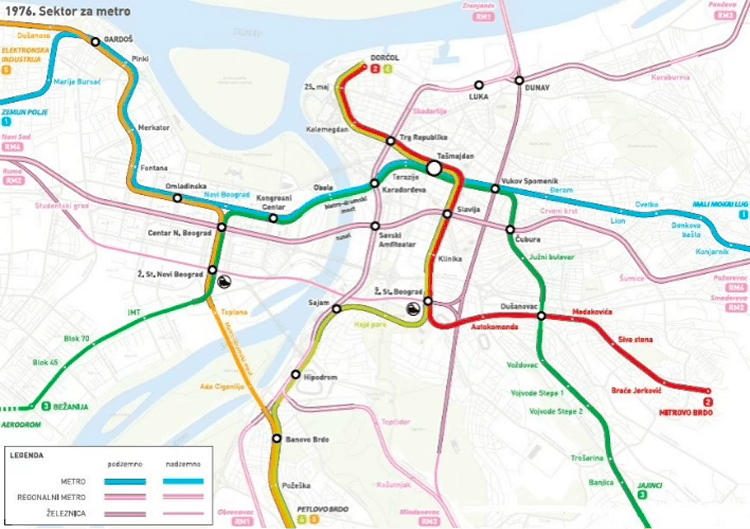
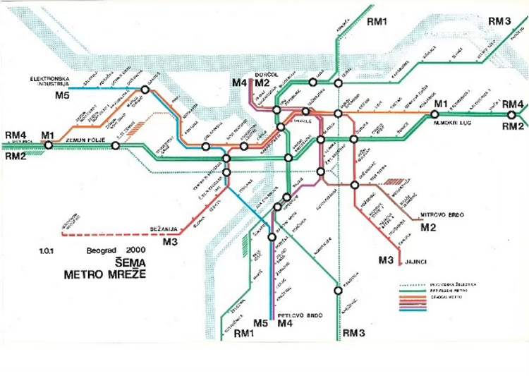
The general urban plan from 1972 projected the development of Belgrade as a metropolis of two million people, shaping the vision of a city whose growth would be accompanied by a modern and long-term sustainable traffic solution. At the center of that concept were two independent shinsk asystems - metro and regional metro - conceived as the foundation of future mobility and spatial development of the capital.
The metro network would consist of five lines, mostly underground routes, which would share common tunnels in certain sections for more efficient functioning of the system. In order to realize such an ambitious network, the construction of two new bridges over the Sava is planned - one on the site of the Old Sava bridge, and the other over Ada Ciganlija - as well as a direct connection to the future main railway station.
At the same time, the regional metro was planned as a supplementary system that would cross the Sava through a tunnel and intersect in the area of the Sava amphitheater, forming a strong traffic hub of the city with a narrower city core.
With this plan, the metro is confirmed as a strategic axis of the urban development of Belgrade - an infrastructural framework that monitors and directs the transformation of the city into a modern European metropolis.
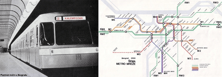
Source: "Study of the technical and economic feasibility of high-speed public transport in Belgrade", 1976.
1982. Redirection to the streetcar system
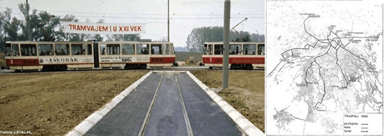
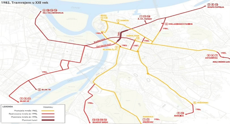
Due to the economic situation at the beginning of the 1980s, the city authorities abandoned the previous conception of the development of the metro network in 1982. The assessment was that the current, as well as the projected volume of traffic, did not justify the construction of a high-capacity and completely independent rail system.
In the new circumstances, the strategic commitment is directed towards the further development of tram public transport. In accordance with those plans, the sections in New Belgrade, Banovo Brdo and Generala Ždanova Street were realized, while the plan included railways to Zemun and Kraburma, with a tunnel through the Belgrade ridge under the terraces.
This phase represents an important moment in the development of Belgrade's traffic policy - a period in which economic circumstances shaped infrastructural priorities, but also temporarily delayed the realization of the long-term vision of the metro system.
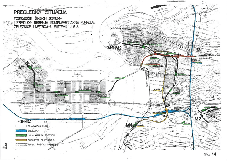
1989. The "Premetro" concept, Realization of connecting the facilities of the railway junction with other rail systems in public transport in Belgrade
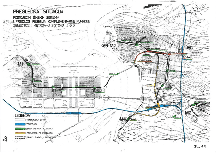
The study on the implementation of the connection of the facilities of the railway junction with other rail systems in Belgrade considered the possibilities of establishing a transitional model of the functioning of public transport - the so-called premetro system.
Starting from the fact that the construction of the metro is a long-term and complex infrastructure undertaking, the study analyzed ways to ensure a more efficient connection of the railway junction with the existing city rail systems in the interim period. The goal was to improve flow, better integrate different modes of transportation and create a basis for the future full implementation of the metro network.
Although the metro remains a strategic commitment and the foundation of the long-term development of public transport in Belgrade, the concept of the premetro system was an attempt to, through phased implementation and adapted technical solutions, ensure the continuity of development and gradually improve the overall traffic structure of the city.
1993. Transport systems of Belgrade, Part II, Public transport development strategy
In the document Transportation Systems of Belgrade Part II, which was adopted by the Assembly of the City of Belgrade and the Serbian Academy of Sciences and Arts, special attention is paid to the strategic consideration of the further development of public transport.
It was pointed out that the choice of a type of transport with a higher capacity must be the result of a careful comprehensive analysis not only from the point of view of transport capacity and the satisfaction of growing traffic demands, butand in terms of economic indicators, spatial organization of work and proper selection of development corridors.
As an optimal solution, a light metro is envisioned as a modern, efficient and adaptable rail system, which would respond to the needs of Belgrade in development. At the same time, it is planned to retain and improve the existing railway and tram sections, which would ensure the functional connection of different rail systems and the gradual transformation of the entire traffic network.
This document represents an important step in redefining Belgrade's long-term traffic strategy, confirming the continuity of commitment to the development of rail systems as the foundation of infrastructural mobility.
2002–2004. Plan de transport collectif
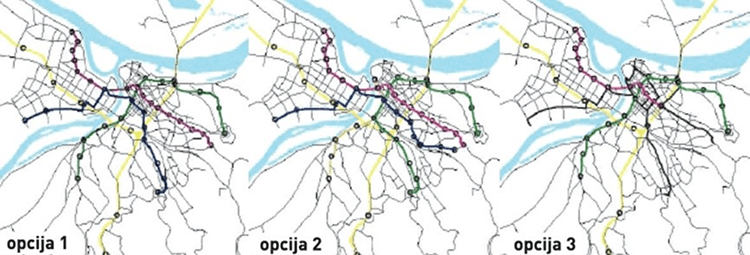
The general urban plan from 2002 envisaged the modernization and improvement of the existing tram system through the construction of three new sections of the light rail system - the light metro - with the gradual integration of the existing tram routes into a single, more modern network. This approach was based on the idea of phased development, which would enable the technical and functional transformation of the system with the rational use of the existing infrastructure.
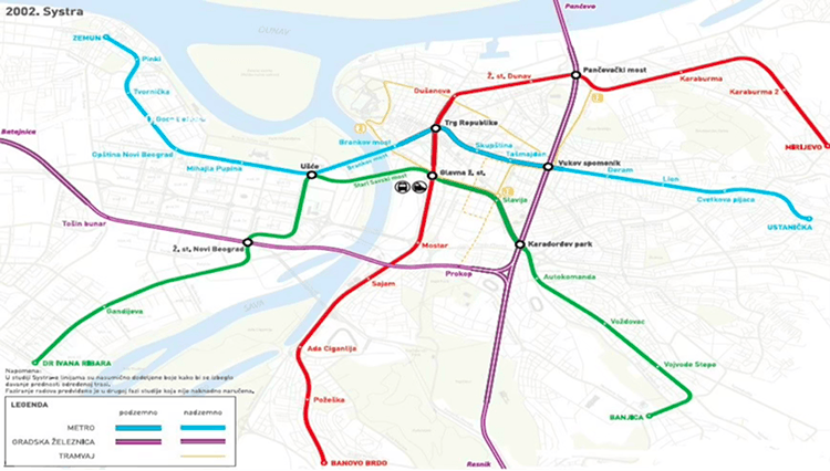
The French company Systra was entrusted with the preparation of a study on the reorganization of urban transport in Belgrade. After the conducted analyses, a new development direction was proposed, which deviated from the General Urban Plan. Instead of upgrading the existing system, the study offered its own vision for the development of the city and the network of a high-capacity rail system, adapted to the long-term needs of the metropolis.
Of the three considered variants of development, the option from that line was singled out as the most promising for further elaboration and feasibility study, which continued the process of defining the optimal model of the future metro system of Belgrade.
Source: Systra - "Plan de transport collectif de la municipality de Belgrade", September, 2002.
2003. Belgrade General Plan, Belgrade City Assembly and Belgrade Urban Institute
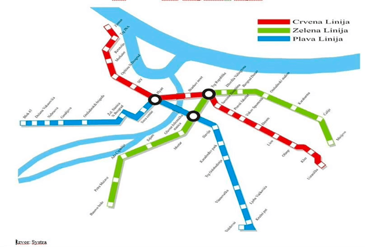
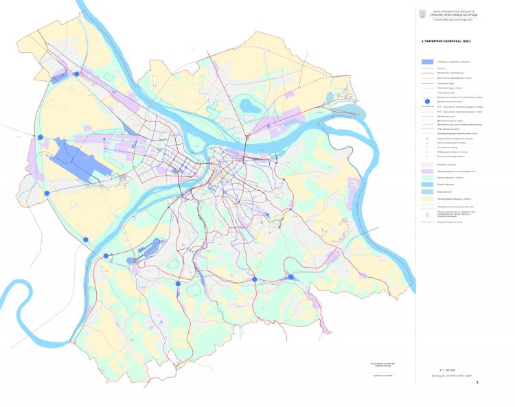
The general plan of Belgrade is based on the principles of revitalization and rehabilitation of the existing modes of public transport, with the gradual introduction of a modern urban rail system of the LRT type (light rail system). This approach implies a phased modernization of the traffic infrastructure, along with the preservation and improvement of already established networks.
This established a strategic framework for the development of the public transport system that connects different levels of mobility - from the central city zones to the wider city area - creating the foundations for an efficient, sustainable and long-term adaptable transport system in Belgrade.
2004. Light metro concept (BeLaRT)
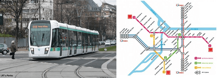
In accordance with the principles of the General Urban Plan from 2002, the project of the first line of the light metro was developed, conceived as an initial step in the transformation of the city's rail system.
The planned line connected Bulevar Kralja Aleksandra with the city center and New Belgrade, establishing a strong traffic connection between the eastern and western parts of the capital. In the central city zone, the route was planned underground, on the stretch from the Wolf Monument to the Varoš Gate, which would ensure the efficient functioning of the system in the busiest part of the city.
The crossing over the Sava is planned with a new bridge, downstream from the Branko bridge, while the route in New Belgrade is designed as a surface route, with a fork in two arms. Along Bulevar Kralja Aleksandar, the line would also be run on the surface, allowing better integration with the existing structure.
Although the track of the new system was designed with a wider profile compared to the existing tram, the plan provides that, with the use of the third rail, the use of the new route will also be enabled by existing vehicles. This would ensure functional compatibility and a gradual transition to a more modern system.
The project, in addition to the first line, also envisaged two routes - to Banovo brdu - via Prokop and the new bridge on Ada Ciganlija - which would form the basis of the future light metro network of Belgrade.
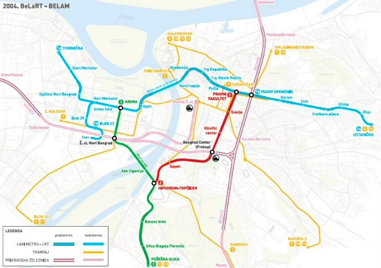
Source: Directorate for Building Land and Construction of Belgrade, "Preliminary Study of the Justification of the Construction of the First Line of the Light Rail System with the General Project", 2004.
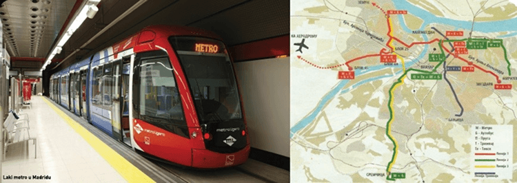
2011–2012. EGIS - Study of the Belgrade Metro
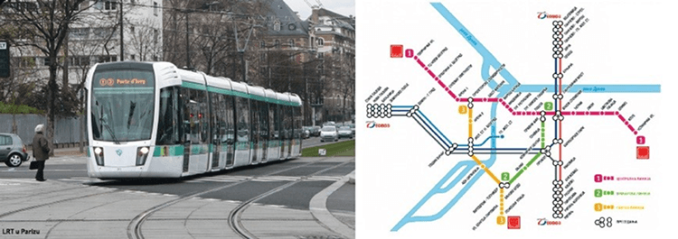
In 2011, the French engineering company Egis was entrusted with the preparation of the Belgrade Metro Study, based on the solutions of the General Urban Plan from 2002. The study defined the concept of a network of three light metro lines, with the possibility of their upgrade phase into a high-capacity metro system, in accordance with the city's long-term development projections.
The proposed route is adapted to the urban and spacious characteristics of certain parts of Belgrade. In the central city zone, the line is planned underground, under the Bulevar Kralja Aleksandra, as well as in the area of Čukarica, name would ensure efficient functioning in the busiest parts of the city.
In New Belgrade, the system is designed as elevated, supported on pillars, while in Višnjička Street and Jurija Gagarin Street, a surface route is planned.
Connecting the old and new models of the city is planned with the construction of a new metro bridge in the area of the Branko bridge, as well as by crossing the Ada bridge, which would ensure a reliable and high-capacity connection across the Sava.
In the first three phases of implementation, the construction of Line 1, on the stretch from Zvezdara to New Belgrade, with a fork towards the Sava blocks, is foreseen. This line would represent the initial backbone of the future metro network and an important step in the establishment of a modern, integrated rail system in Belgrade.
2012 - Studies of the general concept of the metro system of the city of Belgrade, EGIS 2012.
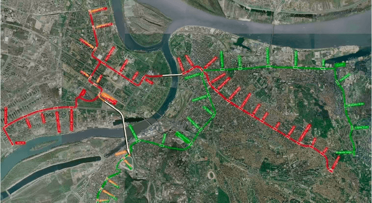
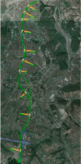
In 2012, the Egis company produced a study of the general concept of the subway system of the city of Belgrade. Which defined a network of three metro lines as the basis for the future development of the capital's rail system.
The study envisages the following lines:
- Line 1: from the western terminus "Tvornička" in Zemun to the eastern terminus in Ustanička Street, with a branch to the railway station "Novi Beograd" and the main depot, i.e. to Block 45;
- Line 2: from the southern terminus "Groblje Orlovača" to the terminus "Mirijevski venac";Linija 2: od južnog termiusa „Groblje Orlovača“ do termiusa „Mirijevski venac“;
- Line 3: from "Orlovački groblje", via Mosta na Ada to the "Tvornička" terminus, mostly using the existing infrastructure of lines 1 and 2.
As part of the Study, Line 1 was developed at the level of the General Project, while conceptual solutions were defined for Lines 2 and 3.
Technical characteristics of Line 1
The section from Tvornička to Ustanička Street was designed with a length of 12.25 km and 22 stations. The branch to the depot, i.e. Block 45, is planned to be 6.25 km long with 9 stations. The total length of Line 1 with the branch is 18.5 km, with a total of 31 stations.
Urban integration of Line 1
Planned solution of metro integration by sections:
- An above-ground terrace with uneven crossings from the "Tvornička" terminus to the Sava River.
- Construction of a new metro bridge in the area of the existing Branko bridge for the purpose of crossing the Sava.
- Deep tunnel excavation (TBM technology) in the central city area, on the stretch from the Varoš Gate to Nikola Pašić Square;
- On the section from Nikola Pašić Square to Ustanička Street, three variant solutions were considered: deep tunnel excavation (TBM), open excavation (Cut & Cover) and a surface route beyond the "Vukov spomenik" station.
Line 1 depot
The study envisages the construction of a depot for Line 1 at the location of the existing GSP tram depot, on an area of approximately 35,200 m2. The planned capacities would enable garages and train maintenance in the short term.
In a longer-term development, after the full implementation of line 1, the existing capacities would be sufficient primarily for maintenance, which would require the provision of additional locations for train garages or the use of new depots planned for the future lines 2 and 3.
This study represents a significant step in the technical and phasic definition of the metro system of Belgrade, laying the foundations for further elaboration and implementation of projects.
2019. Belgrade Metro
The final report of the Preliminary Feasibility Study with the General Project for two lines of the Belgrade Metro, prepared by the company Egis, was adopted in April 2019 by the Commission for the Implementation of the Belgrade Metro Project.
This document defines the technical, spatial and functional parameters of the first phase of the realization of the metro system, which laid a solid foundation for the construction of a modern, high-capacity public transport system in Belgrade.
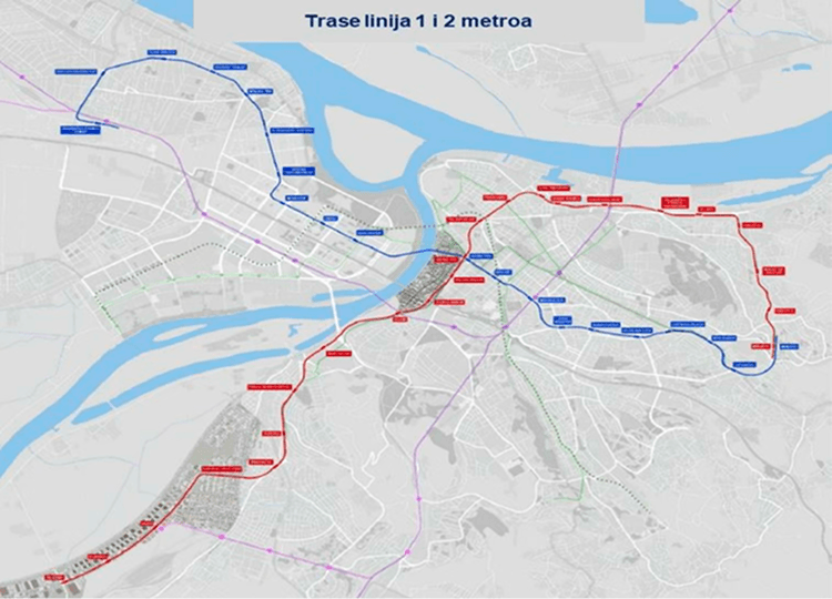
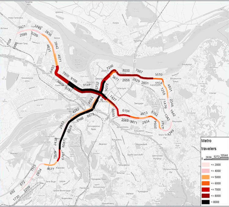
The previous feasibility study with the General Project envisages the construction of two metro lines:
- Line 1: from Železnik to Mirijevo, with a total length of 21.3 km, with 23 stations;
- Line 2: from Zemun to Mirijevo, with a total length of 19.2 km, with 20 stations.
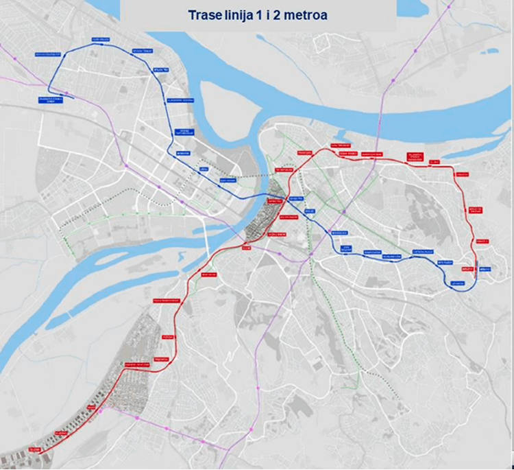
The planned network ensures the connection of key city entities and the establishment of a reliable, efficient and long-term sustainable rail system, which will represent the backbone of modern public transport in Belgrade.
Urban integration
LINE 1
Total length 21.4 km, of which:
- 17.3 km in deep excavation (TBM machine)
- 2km in shallow excavation (Cut&Cover)
- 2.1 km per country.
- 21 stations:
- 17 in deep excavation
- 2 in a shallow excavation
- 2 on the ground
LINE 2
Total length 24 km, of which:
- 22.5 km in deep excavation (TBM machine)
- 1.5 km in shallow excavation (Cut&Cover)
- 24 stations:
- 22 in a deep excavation
- 2 in a shallow excavation
LINE 3
Total length 23 km, of which:
- 21km in deep excavation (TBM machine)
- 2km in shallow excavation (Cut&Cover)
- 22 stations:
- 20 in deep excavation
- 2 in a shallow excavation
Additional information
- Lines 1 and 2 metros connected by common stations in Savski trg, i.e. in Mirijevo
- The main depot for sleeping and maintenance of the complete fleet of lines 1 and 2 in Makiško polje + satellite depot for daily maintenance and sleeping of trains in Zemun
Movement intervals during peak hours:
- Line 1: 119 seconds
- Line 2: 136 seconds
Total number of trains for both lines: 85 three-part trains, of which:
- 48 trains for Line 1
- 37 trains for Line 2
- Commercial speed about 33km/h
- Fully automated control system (degree of automation: GoA4)
- Three-piece train sets
- In order to meet the requirements of the predicted traffic demand for the long-term period, all elements of the metro system are dimensioned for four-part sets
Shared stations with existing and planned lines BG: Train:
- Line 1: Makish, Sajam, Pančevački most and Karaburma
- Line 2: Zemun and Karađorđev Park